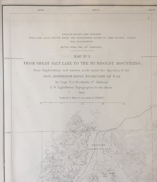
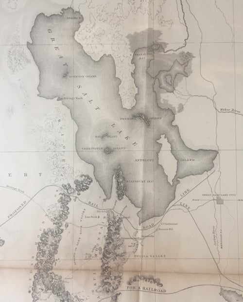
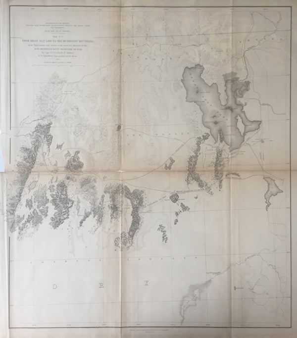
Explorations and Surveys for a railroad from the Mississippi River to the Pacific Ocean | Route near the 41st Parallel Map No. 2 From the Great Salt Lake to the Humboldt Mountains;; from Explorations and Surveys made under the direction of the Hon. Jefferson Davis, Secretary of War by Capt. E. G. Beckwith 3d Artillery E. W. Egloffstein Topographer for the Route
Washington DC: Selmar Siebert's Engraving and Printing Establishment, 1855. Very Good. First Edition. [20.875x18.125in on 22.5x20in sheet]; Title and date in upper left corner, relief shown by hachures and spot heights with drainage, trails and roads, railroad survey lines, trails, Native American territories, communities, magnetic variations, and historic events; Laid flat on archival board; Some age toning along fold crease lines with small chip in center, all neat lines present, prior owner tape repairs to crease lines. [Wagner-Camp 262a:1, Wheat Trans-Miss Maps 823]. Item #13563
From Wagner-Camp, this map was from the Pacific Railroad Reports issued in 1855 Volume II designated by 33d Congress: 2d Session, Senate Document 78. Serial 759 and House Document 91. Serial 792. Volume II consisted of seven reports and Edward Griffin Beckwith (1818-1881) wrote the Section 2 report of the survey along the line of the 41st parallel. In 1853, Beckwith was part of a survey party led by Capt. Gunnison to explore the 38 to 39 parallels. When Gunnison and others were killed by Ute Indians along the Sevier River, Captain Beckwith took charge of the survey party and returned to Salt Lake City for instructions. It was determined that the lower latitude routes were infeasible and Beckwith was given permission to survey along the 41 parallel from the Salt Lake to the Pacific. He started out in May, 1854 and the survey routes recommended generally follow the actual construction of the trans-continental railroad.
Price: $180.00