![Item #14008 The Yukon District; [Stanford's Atlas of Universal Geography, London Atlas Series] [Plate #87]. Edward Stanford.](https://davidspilmanfinebooks.cdn.bibliopolis.com/pictures/14008.jpg?width=768&height=1000&fit=bounds&auto=webp&v=1665682308)
![The Yukon District; [Stanford's Atlas of Universal Geography, London Atlas Series] [Plate #87]](https://davidspilmanfinebooks.cdn.bibliopolis.com/pictures/14008_1.jpg?auto=webp&v=1665682308)
![The Yukon District; [Stanford's Atlas of Universal Geography, London Atlas Series] [Plate #87]](https://davidspilmanfinebooks.cdn.bibliopolis.com/pictures/14008_2.jpg?auto=webp&v=1665682308)
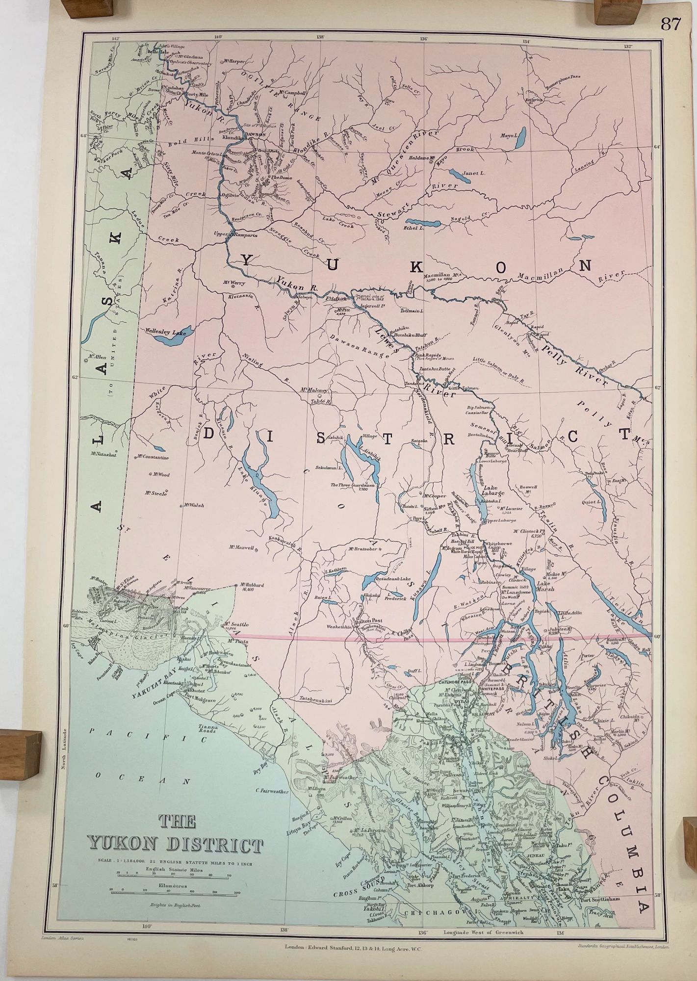
The Yukon District; [Stanford's Atlas of Universal Geography, London Atlas Series] [Plate #87]
London: Edward Stanford (Stanford's Geographical Establishment), 1904. Near Fine. Third Edition. [21.75x14.75in sheet, 20x13.25in neatline]; Detailed large scale color printed map of western Yukon District, Canada, from 58 N to 66 N, details mountain peaks, rivers, geographic features including glaciers, and settlements; no marks or creases, blank verso, faint age-toned along edges, several small chips and pin hole in foredge margin. [Rumsey 0949.099] CS. Item #14008
Edward Stanford (1827-1904) was a British publisher and cartographer. He started his publishing business in the 1850's to provide highly accurate and detailed maps in response the British colonial expansion.
This map was from the library of the late Dr. G. Warren Smith of Pennsylvania. He had a long career as university professor and administrator, and was a collector of over 6,000 books, maps, illustrations, and artifacts relating to the Arctic, Alaska and Pacific Northwest.
Price: $200.00