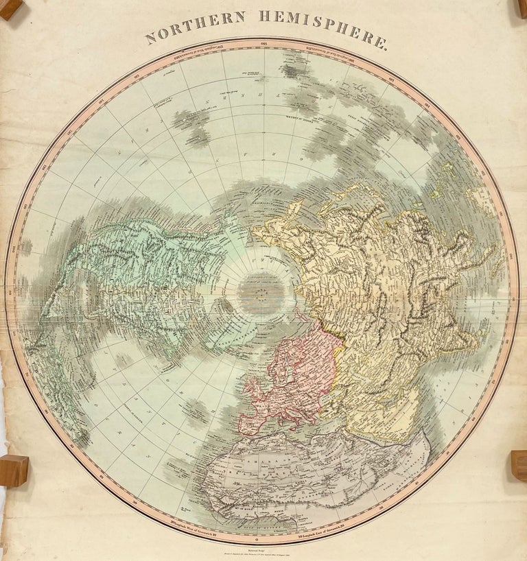
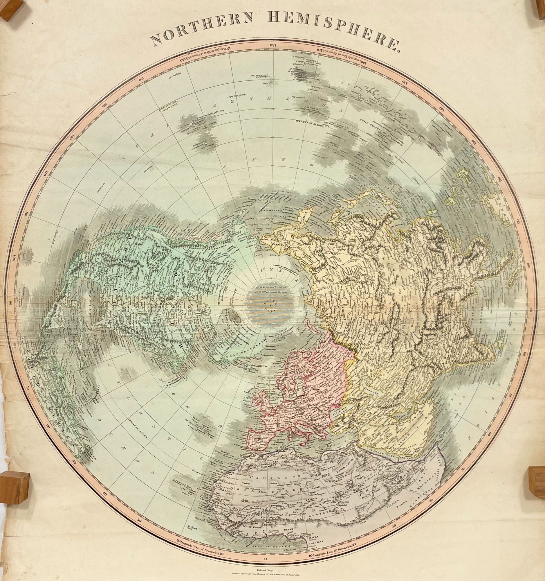
Northern Hemisphere; Kirkwood sculp. Drawn and engraved for John Thompson Co.'s New General Atlas, 12 August 1814 [The New General Atlas, 1817, published at the same time in London and Dublin
Edinburgh: John Thomson and Company, 1814. Good. First State. [19.5in dia. neatline, 22.25x21.5in sheet, folds to 22.25x12.5in] Hand colored map of the entire Northern Hemisphere in great detail with topographic, geographical and political divisions, and cities, full color with general outlines of Europe kingdoms, annotations to various islands and other features; Mild age toning and soiling to left and right edges (which would be the top and bottom edges of the atlas), horizontal fold crease with light rubbing to map surface, on crease line, small area at neatline on right edge of paper separation, small closed tears along same edges with several tape repairs on verso and to crease. [Rumsey 1007.003] CS. Item #14142
John Thomson (1777-1840) was a Scottish Cartographer in Edinburgh. The title page of the Atlas reads, "A new general atlas, consisting of a series of geographical designs, on various projections, exhibiting the form and component parts of the globe; and a collection of maps and charts, delineating the natural and political divisions of the empires, kingdoms, and states in the World. Constructed from the best systematic works, and the most authentic voyages and travels. With a memoir of the progress of geography, a summary of physical geography, and a consulting index to facilitate the finding out of places. Edinburgh: Printed by George Ramsay and Company, for John Thomson and Company, Edinburgh; Baldwin, Cradock, and Joy, London; and John Cumming, Dublin. 1817."
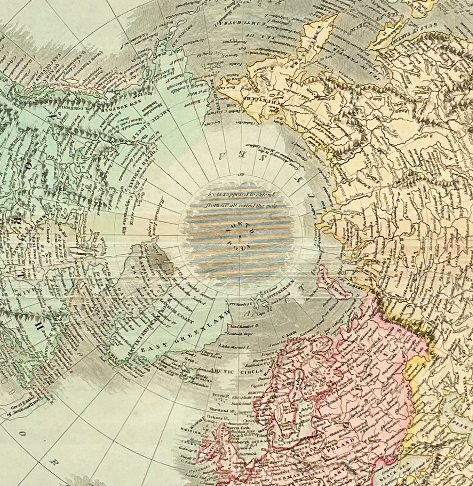
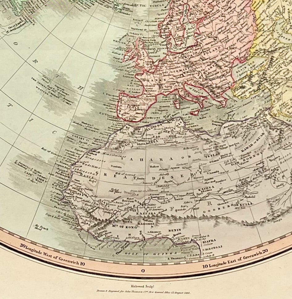
This map is one of the few that shows Vancouver Island with the original name given by Vancouver of Quadra and Vancouver Island. From Wikipedia, "Includes all of North America, Europe, and Asia as well as the northern part of Africa and South America. In Africa the mythical Mountains of Kong are shown extending eastward to join with the Mountains of the Moon – mythical source of the Nile River."
There is limited detail to the North American Arctic and connects Greenland with North America, Discoveries that will be made later in the 19th century.
This map was from the library of the late Dr. G. Warren Smith of Pennsylvania. He had a long career as university professor and administrator, and was a collector of over 6,000 books, maps, illustrations, and artifacts relating to the Arctic, Alaska and Pacific Northwest.
Price: $200.00