
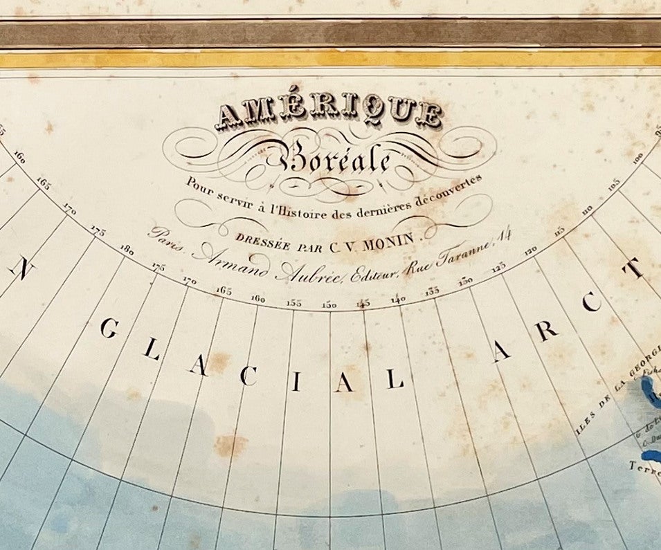
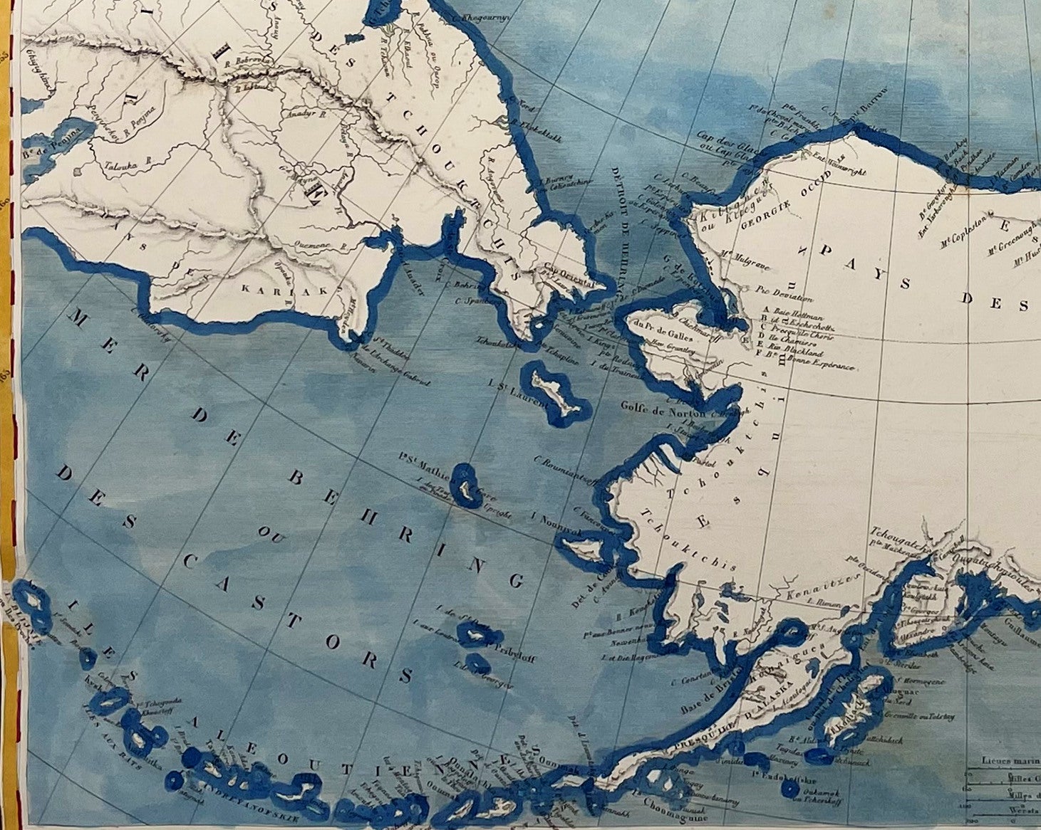
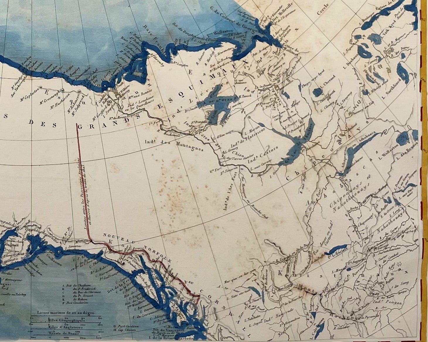
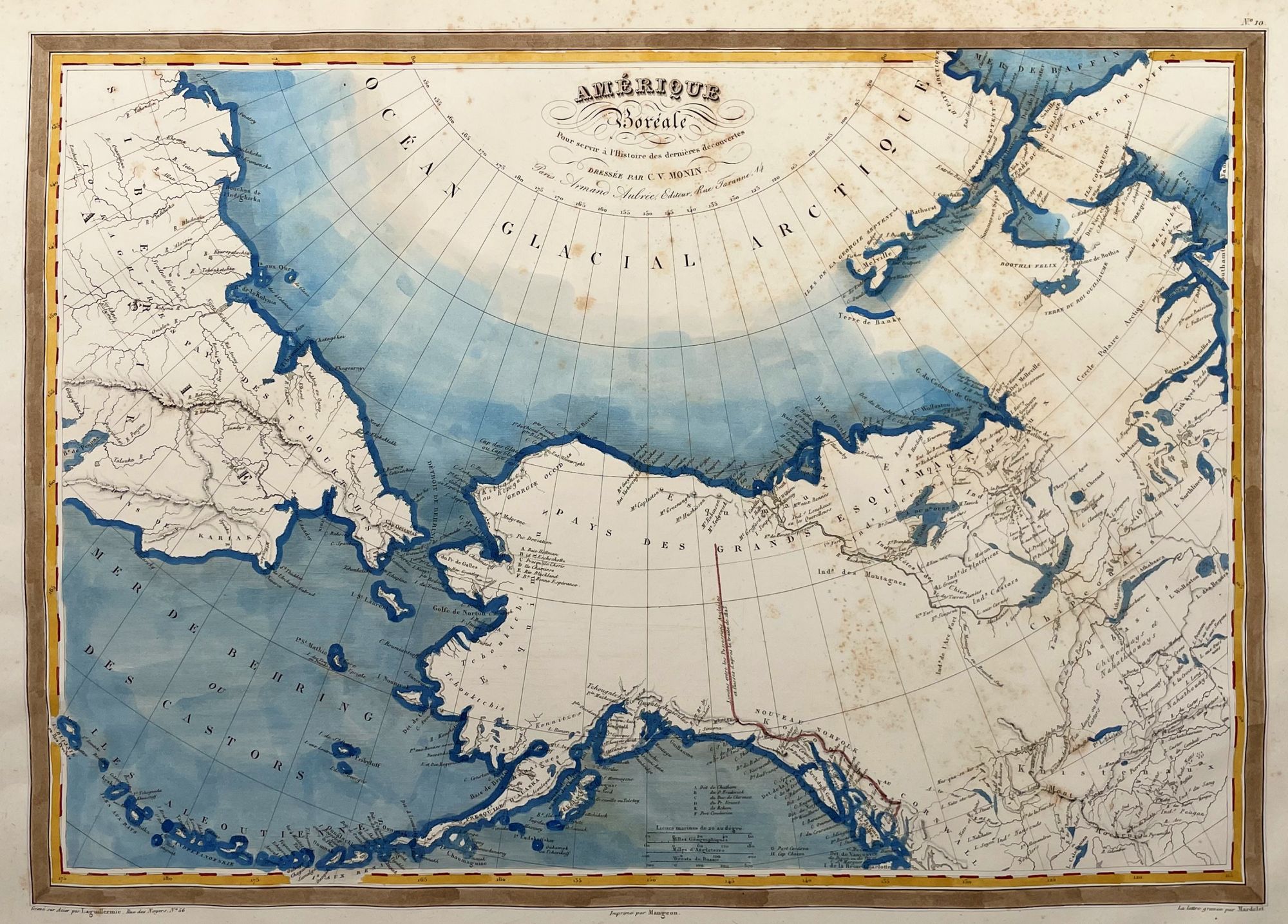
Amerique Boreale; Pour Servier a l'Histoire des dernieres decouvertes
Paris: Armand Aubree, 1837. Very Good. First State. [12.5x17.75in 31.8x45.2cm, 15x22.5in 38x57.2cm sheet] Hand colored map of northwest North America and northeast Siberia centered on Alaska and northern Canada, details the explorations and discoveries at the time, highlights the 1825 demarcation of Russian America and British America; Age toning to edges with light foxing spots in margins and map, remnant of binding trim on bottom margin, older ink lettering on lower right margin, plate number in top right "No. 10", map engraver Laguillermie, imprint Mageon, lettering engraved Mardelet. [Rumsey 2359.023] CS. Item #14150
This map was published, uncolored, in "L'Univers. Atlas Classique Et Universel De Geographie Ancienne Et Moderne" by M. Monin and M Fremin in 1837.
This map was from the library of the late Dr. G. Warren Smith (1941-2021) of Pennsylvania. He had a long career as university professor and administrator, and was a collector of over 6,000 books, maps, illustrations, and artifacts relating to the Arctic, Alaska and Pacific Northwest.
Price: $400.00