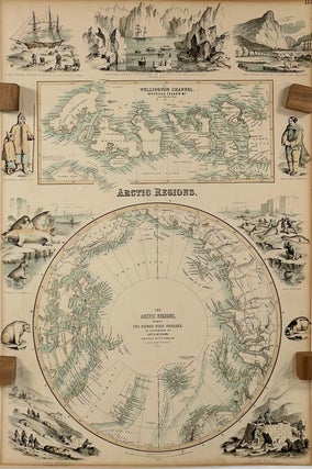
Arctic Regions showing The North-West Passage; as determined by Cap. R. McClure and other Arctic Voyagers. Compiled by J. Hugh Johnson, F.R.G.S. [The Royal Illustrated Atlas of Modern Geography with an Introductory notice by Dr. N. Shaw, Secretary to the Royal Geographical Society, Plate III.]
London: A. Fullarton and Company, 1872. Very Good. Later Edition. [Map dated 1856][18.5x12.5 sheet, no sheet neatline]; Two colored maps - Arctic polar projection to 60 North [9.75in dia.] and detailed inset of Wellington Channel with Melville Island and others [4x9.25in, 74 to 78 N, 90 to 125 W] bordered..... Item #14043